- Home
- News / events
- Avenue Road
- Biggin
- Buckingham Road
- Census 1841
- Chapels
- Charities & poor relief
- Church
- Church Street
- Directories / descriptions
- Enclosure
- Families / people
- Farms
- Fire insurance
- High Street
- Horn Street
- Maps
- Market Square
- Medieval & 16th century
- 19th-20th Centuries
- Oral history
- Parish Council
- Photographs
- Pubs
- Railway
- Redfield
- Schools
- 17th-18th Centuries
- Sheep Street
- Shipton
- Station Road
- Tanneries
- Tinkers End
- Turnpike
- Vicarage & Verney Roads
- Western Lane
- Wills
- Windmill
- Winslow Hall
- Workhouse / Hospital
- World War One
- Sitemap
- Links
- Search site
- About us / contact

Maps of Winslow
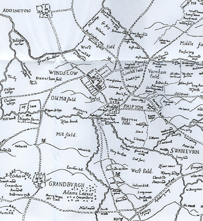 |
This map of Sir John Fortescue's estates, made in 1599, is the earliest surviving map of Winslow. The original has been lost and only photographs are preserved. |
| Map of Buckinghamshire by John Speed, 1610 | 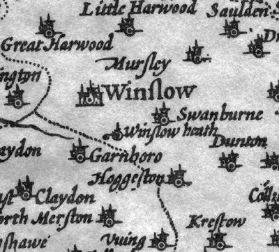 |
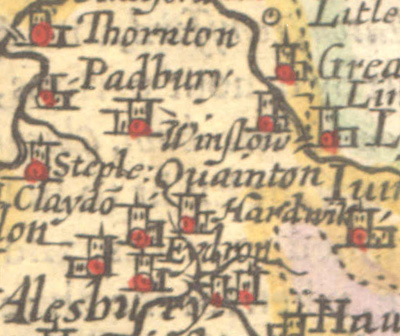 |
Map of Buckinghamshire by Pieter van der Keere, 1662 |
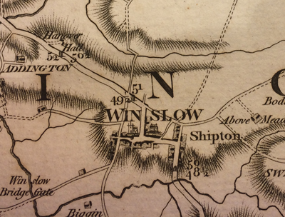
| Map of Buckinghamshire by Thomas Jeffreys, 1770 | 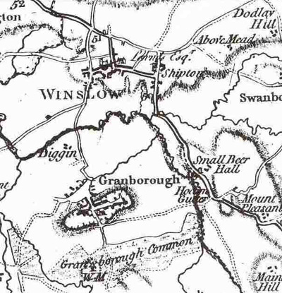 |
 |
Map of Buckinghamshire by John Andrews, 1774 |
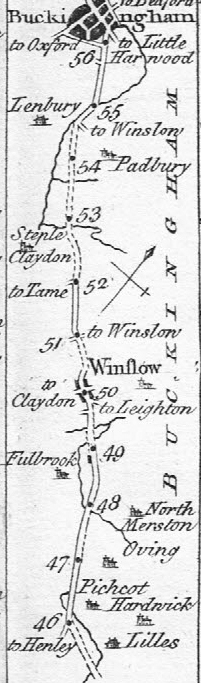
| Bowles's Post-Chaise Companion, 1782 Click on the image for a larger version. This is part of the route from London to Stratford on Avon. If you look closely you will see several errors. |
 |
 | Map of Buckinghamshire by A. Bryant, 1825 |
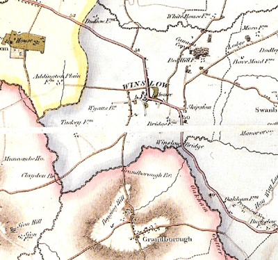
| A map of Cottesloe Hundred, 1847 (just before the arrival of the railway) | 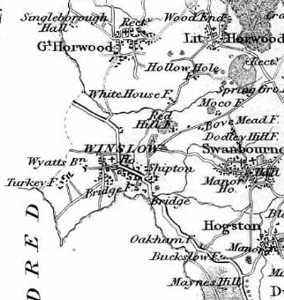 |
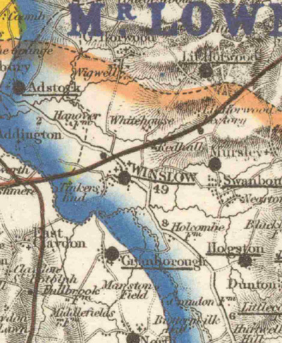 |
Hunting map of 1870 |
| Ordnance Survey map of 1885 - click on the image for a larger version | 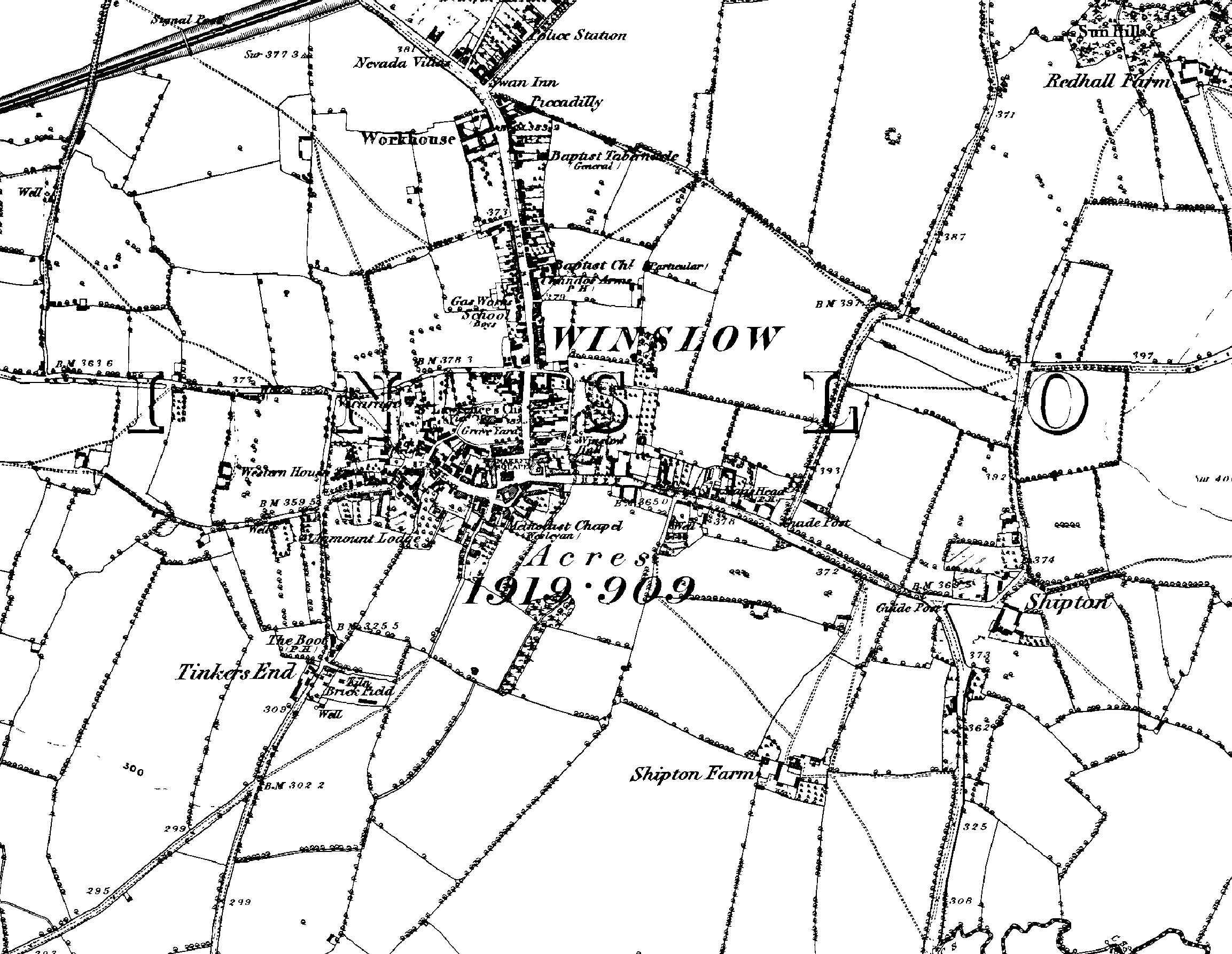 |
 |
Ordnance Survey 1 inch : 1 mile map, 1919 |
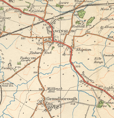
| Ordnance Survey 6 inch : 1 mile map, 1928 - click on the image for a larger version | 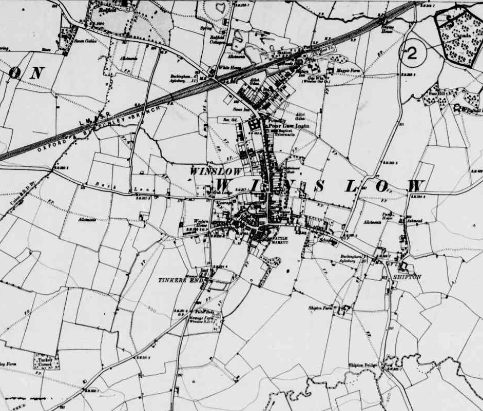 |
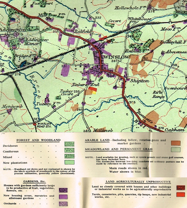 |
Land Utilisation Survey, 1939 - click on the image for a larger version NB The small amount of arable land around Winslow before World War Two |
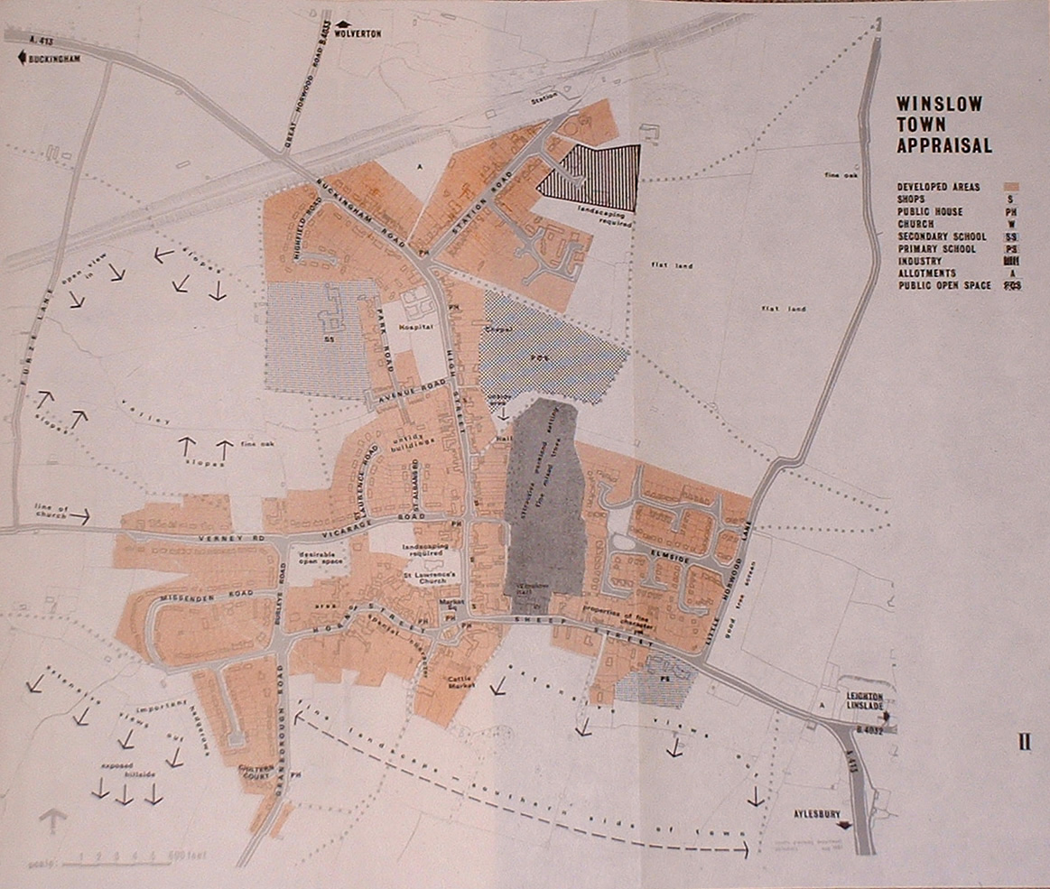
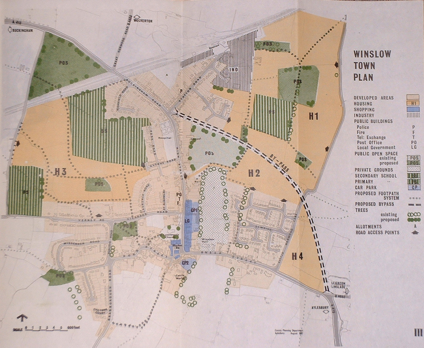
Winslow in 1967 - click on the image for a larger version. This map is a folded insert within the Winslow Expansion Plan of 1967 |
|
| Proposed expansion of Winslow in 1967 (note what did and didn't happen!) - click on the image for a larger version. This map is a folded insert within the Winslow Expansion Plan of 1967. |
| The Relief Road was first proposed in the 1930s. This is how it was envisaged in the 1980s: a roundabout at the end of Station Road, another one where the new road joined Little Horwood Road, and a junction with the A413 at Shipton. Most of the route is now a cycle path. Click on the image for a larger version. | 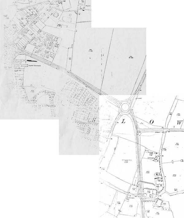
|
Copyright
4 February, 2024