- Home
- News / events
- Avenue Road
- Biggin
- Buckingham Road
- Census 1841
- Chapels
- Charities & poor relief
- Church
- Church Street
- Directories / descriptions
- Enclosure
- Families / people
- Farms
- Fire insurance
- High Street
- Horn Street
- Maps
- Market Square
- Medieval & 16th century
- 19th-20th Centuries
- Oral history
- Parish Council
- Photographs
- Pubs
- Railway
- Redfield
- Schools
- 17th-18th Centuries
- Sheep Street
- Shipton
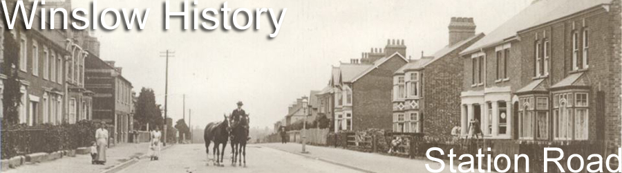
- Station Road
- Tanneries
- Tinkers End
- Turnpike
- Vicarage & Verney Roads
- Western Lane
- Wills
- Windmill
- Winslow Hall
- Workhouse / Hospital
- World War One
- Sitemap
- Links
- Search site
- About us / contact

Winslow road names
by Glenys Warlow (updated Jan 2017, April 2019, May 2020, Jan 2022, March 2024 and Sep 2025 by David Noy)
Winslow road names are derived mainly from two sources: the names of those who have served the community and historical place names.
Some of the historic places are on the earliest surviving map of Winslow, the Fortescue map of 1599. Sir John Fortescue of Mursley, Knight, Chancellor of the Duchy of Lancaster and Privy Councillor bought the Manor of Winslow from the Crown in 1599.The map was drawn to record his new assets.Other names date from the Inclosure Act of 1766. This Act enclosed open fields and common land. It removed existing rights which had enabled local people to carry out activities such as cultivation, cutting hay, grazing animals and collecting wood. At Inclosure land was reallocated and hedges were set around the new allotments.
^ denotes residential streets with professional or business householders on the Register of Electors 1833.
* indicates residential streets recorded in the 1939 Hilliers Street Directory of Winslow.
New roads named randomly after things connected to bricks are not included in this list.
| ANGELS CLOSE | In 1610 William Lowndes rented The Angel (and 94 acres of land). It is listed on Inn records in 1651 & 1671. William Lowndes was born at his Grandfather's house, The Angel, 2 High Street in 1652. In 1713 it is recorded in the Will of William Gyles - "my Tenement in which Thomas Gibbs now dwells known by the sign of the Angel with the appurtenances thereof"'. It ceased to be recorded as a pub after 1828. NB: Angel is Anglo-Saxon for messenger. Angel Close was on the north side of what is now Vicarage Road, east of the junction with Burleys Road, so roughly where the modern road of the same name is situated. |
| AVENUE ROAD* | This road was developed in the area called Norden in 1890. Norden was mentioned in a Lowndes marriage in 1703. No records indicate the origin of this name but it was originally laid out as an avenue with trees on both sides. In landscape terms an avenue is a straight route with a line of trees or large shrubs of the same species along each side to give uniform appearance along its full length and used to emphasize the arrival at a landscape or architectural feature. In archeological terms it denotes a long, parallel-sided strip of land, measuring up to 30m wide, opened at either end with the edges marked by stone, timber alignments or a low earth bank and ditch. |
| BEAMISH WAY | After the Rev. St John Hungerford Beamish 1878-1957. He graduated in 1902 from Corpus Christi College Cambridge with a B.A. and was ordained in 1907. He took his M.A. in 1916 shortly before he became curate at St Laurence. In 1922 he returned as vicar, a position he held until 1957. He was Rural Dean of Claydon between 1928 and 1957, Rector of Addington 1941-1957and held the office of honorary Canon of Christ Church, Oxford between 1951 and 1957. |
| BELL ALLEY* | Running alongside The Bell the alley takes its name from the hotel. NB: The Bell was recorded as an Inn in 1590, it changed to Hotel in the late 1800s. The lane was originally called George Alley after the original George Inn situated behind the Bell (where the present-day restaurant faces the lane). |
| BEVAN COURT | From 1949 Norman Bevan was the Headmaster of the National School in Sheep Street for pupils aged 5-14. When the secondary school was built at Park Road in 1959 (closed in 1988) he transferred to take up the headship. He was also a lay preacher, Councillor and Rural District Council chairman. |
| BOOT CLOSE | The Boot pub in Tinkers End functioned from 1835 to 1997. The new road had been built on land next to it which belonged to Blake House. |
| BRICKYARD DRIVE | The Station Brickyard opened in the 1860s, with its own siding to provide railway access. It was still functioning in 1907 but seems to have closed soon afterwards. The name survived in Old Brickyard Farm. |
| BROOK DENE | This faces the brook which runs across the middle of the Verney Road development site. "Dene" = valley, but it's a developers' invention here, not a traditional name. |
| BROWNS CLOSE |  Reg Brown was the Rural District Council Clerk until 1974 when he became Town Council Clerk. He was later elected onto the Town Council. He undertook a great many other jobs and good deeds. Reg Brown was the Rural District Council Clerk until 1974 when he became Town Council Clerk. He was later elected onto the Town Council. He undertook a great many other jobs and good deeds. |
| BUCKINGHAM ROAD^* | It became the road to Buckingham in 1745. An Act of Parliament dated 1742 permitted a turnpike road through Winslow. Prior to that date the road from Aylesbury to Buckingham by-passed Winslow; the old coach route followed a Roman road from Quarrendon towards Granborough, then headed to East Claydon and emerged about a mile north of Padbury (now the A413). With the opening of the turnpike the route diverted through Whitchurch and Winslow. Daily Old Union coaches travelled between Banbury and London via Winslow. NB: the old and new routes were of similar distance. Until Victorian times Winslow virtually ended at Avenue Road and it was from this point the street was named Buckingham Road. After the Workhouse was built the section between Avenue and Station roads was renamed Union Street. The arrival of the railway triggered house building along the east side of Buckingham Road. Except for a couple of properties the development of the west side of this road did not begin until the 1950s. In the 21st century, apart from the Swan Inn, Buckingham Road is entirely residential but in the 1950s there was a General Store with Nevada Café at No. 10. |
| BURLEYS ROAD | On the site of Burley's Piece, a close of land, which belonged to Henry Burley the owner of The Bull between 1760-1785 where he was publican and baker. Family ownership of the inn continued until 1798. In 1839 a family was recorded living at Burley Villa. NB: a Councillor Burley was on the Rural District council in the 1950s. |
| BYFORD WAY | Ernie Byford (nicknamed Briney) was a porter at Winslow Station. The LMS Railway Company encouraged attractive stations. Ernie tended the gardens and made sure they were well planted with flowers to ensure Winslow won competitions. Ernie was a Leading Seaman on HMS Dragon the ship which fired the last shell of WW1. He was a founder member of Winslow British Legion in 1925. |
| CARTERS GATE |  The Carter family owned some of the land on which the "Glade" development has been built (see also Saham Croft Close). H.G. Carter, known as Barabbas, was a smallholder in Verney Road. The Carter family owned some of the land on which the "Glade" development has been built (see also Saham Croft Close). H.G. Carter, known as Barabbas, was a smallholder in Verney Road. |
| CHANDOS CROFT | The Chandos Arms was destroyed in the Winslow Air Disaster of 1943. |
| CHEQUERS END | No information available, the name was chosen by Grand Metropolitan Railway Country Estates. Could it have been inspired by William Lowndes Secretary to the Treasury? The Prime Minister's retreat Chequers probably got its name in the 12th century when it was built by Elias Ostiarius, the name meant an usher of the Court of the Exchequer. |
| CHILTERN COURT | No information available, the name was chosen by the builder. |
| CHURCH STREET / WALK^* | A cluster of cottages built near the parish church. One stone is dated 1726 from the time alterations took place. The area is one of the earliest in the town. John Morecraft was shown as owning houses in Church Lane in 1733. |
| CLAREMONT CLOSE | The large house built by the coal merchant Charles Clare in the 1870s (23 Station Road) was originally called Claremont, later changed to Northolme. |
| CLAYCUTTERS | A house with a pottery was established in a converted cowshed around 1960. It was demolished in 1988 for housing. |
| COMERFORD WAY | Denis Comerford was the last Winslow railway signalman. He worked there from 1937 until he was made redundant in 1968 when the railway closed. He lived at No 11 Station Road. |
| COPSE GATE | Took its name from an area where a small group of trees grew close together. |
| COURS LA VILLE CLOSE |
This celebrated the town's twinning with the French town of that name (started in 1980). |
| COURT HOUSE CLOSE | On the site of the old Police Station (1833 -1985) which fronted Station Road and the Magistrates Court (1857-1980) directly behind. |
| CRICKETERS ROW | Opposite the cricket field. In 1886 Winslow had two cricket clubs – Court (the members were drawn mainly from Parnell & Sons' workmen who were upgrading Redfield) and Town. |
| DEMORAM CLOSE | From the name of a field which was recorded as Demeram in the Court Rolls of 1509-32, or Demerham field as it was written on the Fortescue1599 map. It covered a large swathe on the west side of Winslow. |
| DENE CLOSE | The ground which rises towards Shipton was known as Dene Hill. It was the site on which King Offa is reputed to have built his palace in the 8th century. |
| DOVE HOUSE CLOSE | On the Winslow Hall estate there were two fields known as Big and Little Duffers (Buckingham dialect for dove-houses). Dove houses or dovecotes were free-standing structures which housed pigeons or doves, they had pigeonholes for the birds to nest. These birds were important historically as they were kept for eggs, flesh and dung. |
| ELMFIELDS GATE ELMSIDE |
The area got its name from the elms on the Winslow Hall estate; they were felled due to Dutch elm disease. Norman McCorquodale (town benefactor – he built the St Laurence Room in 1913) of Winslow Hall died in 1938; the estate was sold soon after. The greater part of the 28 acres was sold on to Grand Metropolitan Railway Country Estates for building after WW2. The house was sold to demolition contractor Thomas Oakley Ltd in1947 but without permission to pull it down it was resold. By 1965 the new housing estate was established. Elmside roughly follows an earlier field boundary. |
| FAIR MEADOW |
Commemorates the historical sheep fairs held on Sheep Street. |
| FEATHERBED CLOSE | The road running north-south between Buckingham Road and Verney Road was traditionally known as Featherbed Lane but is now officially Furze Lane (see below). |
| FLEDGLINGS WALK |
From Dr Peter Rudd's interest in ornithology, a subject he wrote about. |
| FURZE LANE* | This lane was laid out by the Enclosure Commissioners in 1765 to enable farmers to get to their new allotments. The hedges are thought to date from this time. NB: Furze is a type of gorse bush. It was originally known as Featherbed Lane - meaning land with soft soil. One house existed there in 1939. |
| GEORGE PASS AVENUE | George Pass (1864-1951) was headmaster of Winslow School, founder member of Winslow United F.C., and an active fundraiser during both World Wars. Read more. |
| GIBBS CLOSE | The Gibbs family was very prominent in 18th-century Winslow, particularly the two generations of six bellringing brothers. Read more. |
| GRANBOROUGH ROAD |
Formerly called Claydon Road; it leads to Granborough. |
| GREYHOUND LANE | There was a Greyhound Inn on High Street shown in records dated 1753 & 1821 (also called Hare & Hounds / Greyhound & Hare). Greyhound Lane was little more than a back alleyway exiting on High Street. It was the site of printing works founded in 1836 by Henry Wigley. The works changed ownership and closed c1957. |
| GUBBLESGORE | The name Gubblesgore was used after Enclosure for the field west of Buckingham Road, and a house with that name was built on it in the 1920s. The new road is south-west of the field. The name is first recorded as Bubbesgore in the 1330s. A gore is an irregularly-shaped piece of land, and it probably belonged to someone called Bubba. |
| GYLES CLOSE |  The Gyles family were Winslow's leading Baptists in the 17th-18th centuries and responsible for building Keach's Meeting House. The Gyles family were Winslow's leading Baptists in the 17th-18th centuries and responsible for building Keach's Meeting House. |
| HAWLEY'S LANE | Adjoining Brook Hall it is named after a successful business man George Hawley who was a grocer and tallow chandler in the late 18th century. He had a shop on Market Square. |
| HAZLETON | Gladys Hazelton was the last survivor of the Stock sisters of Oak Lodge who owned the land on which "The Glade" is built; see Stocks Lane. Her husband Philip Hazelton died in 1954. The name has been spelled incorrectly on the road sign. |
| HEDGE FURLONG | 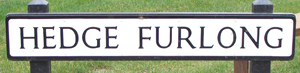 Hedge Furlong was a furlong name in New Mill field before Enclosure, recorded in 1683. Hedge Furlong was a furlong name in New Mill field before Enclosure, recorded in 1683. |
| HIGHFIELD ROAD | This small housing development was built on a field at the north end (high end?) of town. It had been used for sports including tennis. The properties were built in the 1950s. |
| HIGH STREET^* | Until the 1830s only the section from Vicarage Road to Avenue Road was called High Street. Between Market Square and Vicarage Road it was called Cow or Great Cow Street from the early site of the Cattle Market. The town proper did not extend beyond Vicarage Road. There were a few properties on the right - a couple of houses, the Parish Poorhouse and a few old thatched cottages belonging to the parish, the last one located near Cantell's. From 1745, when the Turnpike changed the route, Old Union coaches passed along the road twice daily. In 1235 the market place was carved out between Horn Street and the Churchyard. At the same time Great Cow Street (High Street) was laid out running north from Market Square. The shops were built on rectangular plots running back to a rear access road, later known as Greyhound Lane. Records indicate the name changed to High Street between 1833 and 1839. High Street is a generic name given to the primary business street of a town. In 1910 Union Street was renamed High Street due to the stigma attached to the Union of Workhouses. In the 1939 Hilliers Street Directory (which listed every householder in Winslow) there were almost 190 named under High Street. The next most populous was Station Road with 58 names. |
| HOME CLOSE | Traditionally an area close to home. With Winslow Hall opposite it is clear how its name derived. On the site was an ancient blacksmiths and house said to have been in the Jackman family for 300 years. The blacksmiths and three cottages here were pulled down to improve the view from Winslow Hall. Recorded by William Lowndes in 1720 – "cottage in Sheep Street surrendered to William Lowndes" - "Demolished to open the view from my sons house towards Granborough." |
| HORN STREET^* | Originally this was called Great Horn Street after the Longhorn cattle which were bred in the Winslow area. The shape of the road is similar to a horn. It is one of Winslow's oldest roads. Sheep Street with Horn Street formed the principal road which ran east to west through Winslow (it is likely it was a track through Bernwood). This area became known as the old town. In 1833 the name Great Horn was still in use but by the 1841 census it had been shortened to Horn Street. |
| HORSEMEAD PIECE | The name is first found in a document of c.1635 (but Horsemead occurs much earlier); it was mainly to the west of where Furze Lane is now, so not quite on the site of the new road. |
| INGRAM LANE | The site of the Station Brickyard was bought by Henry Ingram in 1897. After brickmaking finished, his son Frank Ingram ran a smallholding there. |
| JOHN RAWBONE CLOSE | John Rawbone was curate of Winslow from at least 1751, and vicar from 1765 until he died in 1775; also vicar of Granborough from 1756. He also seems to have been master of the Rogers Free School, where he was succeeded by his nephew Thomas Rawbone. |
| KEACH CLOSE | Benjamin Keach 1640-1704 was a tailor in his early years. He was baptised at 15 and at 18 years he started preaching. As a Baptist minister he was tried and spent time in the pillory at Aylesbury in 1664 for producing 1500 copies at 5d of "The Child's Instructor, a new easy primer". His Chapel was a local non-conformist meeting house hidden behind Bell Alley. He moved to London after his trial and remained an influential minister for the rest of his life. He wrote 43 works, of which his Parables and Metaphors of Scripture is the best known. Keach was credited with introducing hymn singing into services. Keach's Chapel dates from 1695 and is one of the oldest of such buildings in Buckinghamshire. There would have been an older building near the site as in 1660 Benjamin Keach was pastor of a small Baptist Church. |
| KENNISH CLOSE | Dr Thomas Kennish owned 'The Cottage' in Horn Street. Scottish, with a drooping Victorian moustache, the GP was well-liked by his patients. In 1912 he was No.9 on the Winslow list of telephone subscribers. Later his home was divided into three cottages. The adjoining stables and farm buildings were converted to form this small development. |
| LACEMAKERS | Lacemaking was the main employment for Winslow women in the 18th and 19th centuries. It declined in the 1850s but a philanthropic organisation called the Winslow (Bucks) Lace Industry ran from 1875 to 1925. |
| LAKE CLOSE | Located near an area which flooded in winter. |
| LAMBTONS WAY | Henry Lambton leased Winslow Hall from the Lowndes family 1873-1886. Later he bought Selby Lodge (built by one of the Selby-Lowndes family on the site of Dudslow Farm), which he remodelled and renamed Redfield in 1885. He came from a wealthy Co. Durham family and was a local benefactor, though little else was known about him. His daughter Dorothy Lambton ran 'Votes for Women' meetings in 1918. She opened a children's home at 2 Park Road and was a governor of The Latin School. |
| LANGLEY CLOSE | After Ralph and Reg Langley who served on the Town Council and were very involved with the football club and other town organizations. |
| LEAPINGWELL LANE | After Dr Arthur Leapingwell 1879-1981. Born in India he was the eldest son of a doctor. |
| LIMES COURT | Built on the Cattle Market site 1875-2007. Its name is taken from the lime trees which have stood on the site since before the Ordnance Survey map of 1885. |
| LITTLE HILL | A furlong name first recorded in 1342 and last mentioned in 1749. |
| LONGLANDS COURT / WALK | There was a close or field on Magpie Farm called Long Piece which may have taken its name, at the time of Inclosure, from an area on the Fortescue 1599 map called Longland. |
| LOWNDES WAY | William Lowndes (1652-1724) came from a family which claimed to be traced to 1066 with the arrival of the Norman - William, Seigneur de Lounde. Sir William was Secretary to the Treasury to William & Mary and Chairman of Queen Anne's Ways & Means Committee gaining the nickname William 'Ways & Means' Lowndes. He was reputed to have coined the phrase 'take care of the pence and the pounds will take of themselves'. As a result of his office he was able to build Winslow Hall in 1700; it was the first time Winslow had a manor house. It was extensively improved by his descendants. The Lowndes family paid for alterations to the Parish church. In 1766 his father Robert promoted the Enclosure Act. The family inherited Whaddon Hall from their friend Thomas Selby (they added Selby to their name under the terms of the will). They moved to Whaddon in 1772 leasing out Winslow Hall. |
| MAGPIE WAY | The principal road through the housing estate built in the 1970s on Magpie Farm (dated 1840). |
| MARKET SQUARE^* | In 1235 the Abbot obtained a charter from Henry lll to hold a weekly Thursday market and annual fair on the feast day of St Laurence - 10 August. The market place was carved out between Horn Street and the Churchyard. The Bell Inn dates from c.1577. The market place had a bull ring, stocks, whipping post, a timber and plaster market house on pillars (demolished in c.1840) and a market cross (1427). In the early1500s it was known as the Bullryng, the Meat Market, and 150 years later the Beast Market, the Cow Market and the Butter Market. Stalls were set out around the Square for traders on market days. The sheep market was held there in the 1800s. On properties 11, 14, 19, 21 and 23 there is evidence, beneath their later exteriors, that they originate from Tudor times. No. 27 - Market House, alongside the Mahabharat Indian Restaurant was demolished in 1948 to enable buses to leave the Square. |
| MCLERNON WAY | H McLernon was a Signalman at Winslow Station. He was a Colour Sergeant in WW1. His son George was mayor of Winslow in the 1980s. |
| MEETING OAK WAY | This name perpetuates the tale (probably a 19th-century invention) that the original settlement of Winslow was closer to Shipton and the elders and dignitaries held their conferences under a very old oak tree in Little Horwood Road. |
| MILL CLOSE | On the site of the town mill, which was powered by an internal combustion engine (one of the first in the county) at the beginning of the 20th century. It was operated by the father of Ernie Byford. The family lived in Mill House at the entrance to Mill Close; now owned by the local Conservative Assoc. |
| MILLGROUND FIELD | 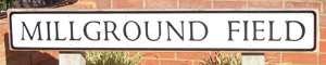 Most of the Verney Road development is in a large field allocated to William Lowndes at Enclosure which was called Mill Ground because the windmill was immediately to the east. The field to the north, where the school and station are now being built, was Mill Knob. Most of the Verney Road development is in a large field allocated to William Lowndes at Enclosure which was called Mill Ground because the windmill was immediately to the east. The field to the north, where the school and station are now being built, was Mill Knob. |
| MINTER RISE | 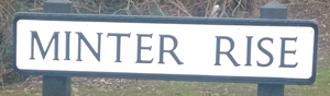 William Vincer Minter was master of the Workhouse 1850-1894, and tranformed it from a more or less penal institution to somewhere which looked after those who had nowhere else to go. Many members of the Minter family worked in workhouses around England. William Vincer Minter was master of the Workhouse 1850-1894, and tranformed it from a more or less penal institution to somewhere which looked after those who had nowhere else to go. Many members of the Minter family worked in workhouses around England. |
| MISSENDEN ROAD | Councillor Missenden was Chairman of Winslow Rural District Council when the first council houses were built in Winslow under the 'homes for heroes' scheme (following WW1) in the 1920s. The Land Army girls had a depot here during WW2. The Council added houses to the area in the 1950s. |
| MONKEY ALLEY | The British Legion was built where a row of cottages known as Monkey Alley (one of the residents owned a monkey) once stood. These cottages were destroyed when a Wellington bomber, on its return to Horwood airfield, crashed on 7 August 1943. Properties on the High Street (the entrance to Elmfields Gate) were also destroyed in this tragic accident. |
| NORTH CROFT | The name was proposed by Mr Bates from North Marston who was one of the first occupants. |
| OAK WAY | From the field named Oak Furlong. |
| OFFAS LANE | Named after Offa King of Mercia who in the 8th century had a palace at Dene Hill. He founded the Abbey at St Albans in 792. |
| OLD MILL FURLONG | The name of the field where this road is situated. |
| OLD STABLE YARD | Site of stables. |
| OLD TANYARD CLOSE | On the site of a tannery which belonged to the Blake family before 1740; the site covered about an acre. Tanneries were an important industry for Winslow. See also The Tannery. |
| ORRELL PLACE | Orrell Hill and Orrell Slade (with many other spellings from Horrill to Orwell) were two of the furlong names on the 1599 map. |
| OVITTS CLOSE | This commemorates the bravery of William Ovitts a local man who served in the Seven Years War (1756 -1763). A global war which involved most of the great powers of the time - Europe, North America, Central America, the West African coast, India, and the Philippines. The war was driven by the antagonism between Great Britain and the Bourbons (in France and Spain) which resulted from overlapping interests in their colonial and trade empires. In 1758 Ovitts joined Elliott's Regiment of Light Dragoon famous for their brave actions. Finding himself the surviving soldier he rescued the Prince of Brunswick when he was captured by the French. Ovitts killed all three soldiers and although badly injured he returned the injured Prince to his base. He was offered promotion, which he refused, and 100 guineas to ensure he got the best care for his injuries. He returned to Buckingham to open a rope and sackcloth factory. When he was 90 he found himself in straitened circumstances in the Workhouse. The Duke of Buckingham, aware of his character and conduct, gave the old soldier a 1/- a day until he died in 1830. |
| PALMERS PATH | The Palmers were one of the most important families in 15th-16th century Winslow. |
| PARK ROAD* | Name in use by at least 1895 (called Park Street in one place). There was no park, and it was probably invented by the developer to give a genteel air like Avenue Road. |
| PARSONS CLOSE* | Recorded as early as 1660 in the Court of Survey. It was the site of the Parish Tithe Barn a large building which was 96.5ft long by14ft wide. It was later used to house four-horse stage waggons before being converted into two tenements, one of which was called Laburnam Cottage. |
| PICCADILLY* | This name possibly derives from 1695/6. William Gyles haberdasher of Winslow was held responsible for obstructing the road to Adstock at a place called Pickles by making a ditch and hedge. The origin of the word Piccadilly as a place name comes from 'pickadil' which was 'the round hem, or the several divisions set together about the skirt of a Garment or a stiff collar, made in fashion of a Band' sic. The area therefore got its name because it was on the outskirts of the town or because it recalled the home of a tailor. |
| PORTWAY | The ancient name given to a path leading to a market. In Winslow the route runs between Piccadilly and the Little Horwood Road and was the proposed site of the town bypass. Now it forms part of Sustrans cycle route 51. |
| PUMPUS GREEN | Bucks dialect for pump house. There was an old water pump house in a field near Winslow Hall. It was used by gas and electricity companies. |
| ROGERS WAY | Joseph Rogers, currier, set up Winslow's first permanent school under his will of 1722. The trustees bought some land at Kimble which they still own, and the Rogers Trust provides educational grants. |
| ROLFE CLOSE | After Jessie and Bert Rolfe. Jessie was the district nurse and midwife for 40 years; she delivered more than 1,000 babies. They moved from Horn Street to a purpose-built house with a treatment room in Highfield Road. Bert was born in a small cottage on High Street in 1893. He was a signalman at Winslow Station and worked on the railways for 40 years. |
| RUDDS CLOSE | Dr Peter Rudd (1920-1987) came to Winslow as a GP; for 30 years his work included the medical care at the hospital and he did much to improve conditions for the patients. In his book Winslow Hospital he chronicles its history from the Workhouse to its demise. When he qualified in 1942 he joined the Royal Navy as a Surgeon Lieutenant. He saw action with anti E-boat patrols in the North Sea; off Iceland - the Russian convoys; D-Day landings off the Normandy coast and the Rangoon invasion. He joined Dr Leapingwell in 1946 and in 1947 acquired the practice at Norden House. Apart from being a doctor he was a regular contributor to 'Pause for Thought' and 'Ten to Eight' fore-runners of Radio 4s 'Thought for the Day'. Such was his popularity he was chosen for 'Pick of the Week and Pick of the Year'. He retired in 1985. |
| SAHAM CROFT CLOSE |
Chosen by the builder Barabbas Carter, it records his place of birth in Norfolk. |
| SCOTT EVANS COURT |
Named after a British Legion official; the flats were originally built and owned by the Legion. |
| SELBY LANE | 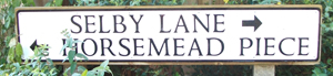 William Lowndes of Winslow Hall (great-grandson of the builder) changed his name to Selby in order to inherit Whaddon Hall in 1782 under the terms of the will of Thomas Selby. After that the family was usually called Selby-Lowndes. William Lowndes of Winslow Hall (great-grandson of the builder) changed his name to Selby in order to inherit Whaddon Hall in 1782 under the terms of the will of Thomas Selby. After that the family was usually called Selby-Lowndes. |
| SHEEP STREET*^ | This road is where sheep sales/fairs were held (the cattle market was on market place and later behind the Bell Inn). Sheep Street, one of the oldest roads in Winslow, was mentioned in a will of 1681. Sheep Street with Horn Street formed the principal road which ran east to west through Winslow (it is likely this was a track through Bernwood). Once the turnpike road was diverted through Winslow in 1745, the street became a busy thoroughfare. The Regulator was bound for London every Monday, Wednesday, and Friday and returned on alternate days. It started from The Bell, a coaching inn. Two other coaches - the Old Union ran between Banbury and London daily. There were also other lumbering Stage Waggons drawn by four horses. In Hilliers Directory of 1939 Sheep Street was the third most populated street. |
| SHEPHERDS ROW |
From the sheep fairs which were held close by on Sheep Street. |
| SPRING CLOSE | The sub soil of Market Square is sand; a strong spring fed the 75ft deep well and others in Horn Street to finally emerge near Spring Close. |
| ST ALBANS ROAD | The Abbey of St Albans was contemplated by King Offa who converted to Catholicism (possibly to atone after he killed King Ethelbert because he coveted his East Anglian territory). He offered Winslow as an endowment to the new Abbey. |
| ST LAURENCE ROAD | The Patron Saint of the parish church who was a deacon of ancient Rome serving under Pope Sixtus II. After the death of Sixtus the Prefect of Rome demanded that Laurence turn over the Church riches. He was granted three days to do this. Working swiftly he gathered Church property then distributed it to the poor to prevent it being seized by the Prefect. On the third day he presented himself to the Prefect and, when ordered to give up the treasures of the Church, he presented the poor, the crippled, the blind and the suffering, saying these were the true treasures of the Church. This act of defiance led to his martyrdom. Tradition maintains that Laurence was burned or "grilled" to death, hence his patronage of cooks and chefs. |
| STATION ROAD* | Called Railway Station Road until 1864. The road existed in 1838 although most of the houses on the north side were built in the mid-1800s. No. 63 was Station Inn. In 1847 Thomas Brassey employed 2000 navvies to build the Bletchley to Banbury railway line; he set aside £200 for their religious education. In 1851 the line opened. There were four trains each way daily. In 1933 there was a thriving coal wharf at the station. By 1939, according to Hilliers Directory (which listed all householders in Winslow) Station Road was the second most populated street. The stationed declined after WW2 and was closed in 1968. |
| STOCKS CLOSE |
The name of the family who ran a dairy business; they owned land in Verney Road. |
| TANK HOUSE ROAD | Named after the 70,000 gallon water tank which provided for the trains. It was situated on the railway bank of Magpie Farm and the area called Tank Meadow. Mr Gayton was the labourer and, with his wife Fanny, got free accommodation in a cottage beneath the tower. Below their rooms the massive pump steamed and sent water to cranes 400m west to the station. The pump was over a pond. In 1909 it caught fire. This destroyed the Gaytons' home and caused the water in the tower to boil! The tank was pulled down in 1970. |
| TENNIS LANE* |
Originally it was called Hobhouchin Lane from the area named on the Fortescue 1599 map. Hobhouchin Lane was referred to in 1775 in the will of Christopher Bigg. It became known as Hobgoblin, the distortion possibly because it was reputed to be where a son murdered his father and then committed suicide, and as a result the area became associated with ghosts and goblins. Another interpretation is it derived from Hobbesbourne, a stream which ran near the lane and often flooded. A Dame school run by Sally Warner existed here, date is unknown, though her ancestor William Warner live here in 1775. In Hilliers Almanack 1939 a 'Private Lawn Tennis Club' was listed in Sheep Street. |
| THE TANNERY |
Named after the enterprise at No 25 which belonged to the Blake family. From Enclosure when new farms were built away from the town, tanneries and leatherworkers were important industries. Most market towns had tanneries where animal skins were treated with tannin and made into leather. The leather was bought by leather dressers, saddlers, glovers and lace pattern makers to be turned into finished goods. See also Old Tanyard Close |
| THE SPINNEY | A small close on Magpie Farm recorded as 'Spinny [sic]Corner'. It is derived from thorny place, a copse that shelters game. |
| THE WALK*^ | An area in town where professional people had their offices or homes. Many of the properties have since been pulled down. The bottom of the Walk was called Hanging Stile until 1830. Local opinion is that the name came from the Town 'lock-up' at the back of the Bell where the Magistrates Court was held until the Court House was built in Station Road in 1857. It has also been called Wigley Walk after George Wigley a local auctioneer who set up the livestock market in Wigley's Yard in 1875 (closed in 2007) and Cowley Walk after John W Cowley MRCS (1778-1856) a surgeon in the 1800s who had his office in Hanging Stile. At the far west end were 3 cottages - Pest houses - which would have been on the edge of town, they were pulled down c.1850. They would have provided refuge / enforced quarantine for persons afflicted with diseases such as tuberculosis, cholera, smallpox or typhus. |
| TINKERS DRIVE | Built on land formerly belonging to Blake House in Horn Street, which was renamed Tinkers Corner in the 1930s. |
| TINKERS END* |
A separate hamlet until the mid-1900s. The name is recorded in 1698. Tinkers End was en route to Biggin where there was a grange of St Albans Abbey. There were at least 17 cottages, a Mission Hall and the Boot Inn (dating from c.1688) well into the 1900s. When the council estate was completed at the west end of Horn Street it effectively linked Tinkers End to the rest of Winslow (the estate was built in the 1920s and 1950s - see Missenden Road notes). A tinker was originally an itinerant tinsmith, a man who mended household utensils. The word is attested from the 13th century. The junction of Granborough Road, Horn Street and Burleys Road was known as Tinkers Corner. |
| TURNHAM CLOSE | |
| VERNEY ROAD | This road leads to Verney Junction. Verney Road replaced Western Lane as the main route to Addington. The railway never prospered, it had been aimed at gentry travelling to London on business. Where Verney Road met Furze Lane it was known as Water Gate. |
| VICARAGE ROAD^* |
Formerly known as Back Lane (or Addington Road) this was the route used before the mid-1800s when the Buckingham Road was developed. It is in 1833 records as Back Lane. The Vicarage was rebuilt on the site fronting Vicarage Road in 1863 (pulled down 2007). Earlier vicarages would have faced towards the church. It is possible the first vicarage was built as early as 1631, although record from 1396 & 1478 refer to a Vicarage. The present Vicarage dates from 1979. The top of the road where it meets High Street was realigned when a house, builder's yard and shop were demolished c.1960. |
| WALNUT TREE CLOSE | There was a preservation order on a large walnut tree on this site which sadly the developers felled. They replaced it with a mature specimen and the road was given this name. |
| WEASEL LANE | A track which runs eastwards from Shipton derives its name from 'Was Hael' a Saxon salutation of travellers meeting. |
| WESTERN LANE*^ | Gave its name to Western House (demolished in 1939) built by the Willis family, which stood near Western Closes from the time of the Enclosure Act 1766. Enclosure also led to the diversion of several old roads. Verney Road replaced Western Lane as the main route to Addington. |
| YEATES CLOSE |
Bridget Yeates was a local benefactor who gave a cottage in Church Walk for use as an Infant school in 1843. It was known as Yeates School (a stone in the wall indicates its location). She left annuities of £166 for the school, for coals & wood for the poor, and for the vicar to run a Sunday school with another £50 to buy books. |
NB: Macadamised surfaces were introduced on roads from 1884. Road classification began in 1913; by 1923 numbers were being used on signs and road atlases.
Clear A, A Thousand Years of Winslow Life, 1894, French Publishers, Winslow
Close, C. Winslow Through Time, 2009, Amberley Publishing, Stroud
Cook, R. The Book of Winslow, 1989, Barracuda Books Ltd
Saving, NA. Glimpses of Past Day Being a Historical Survey on the Town and Parish of Winslow cum Shipton, 1973, Hillier Buckingham
Wigley, A. A Window on Winslow, 1981, Hazell, Watson & Viney Ltd, Aylesbury
Websites: Winslow History,
Wikipedia
With thanks to Terry Foley for information on some roads named by the Town Council
Compiled by Glenys Warlow: if you have any information regarding the origins of Winslow Road Names please email glenyswarlow08@gmail.com.